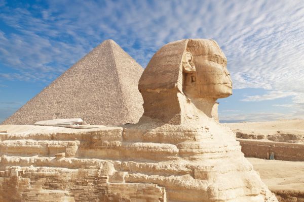
There are no pyramids of Giza or the Sphinx on ancient maps of Africa.
There are no pyramids of Giza or the Sphinx on ancient maps of Africa. Were they not there then? We are dealing with another mystery
Starting with the maps of Africa of the 13th century and ending with the Mercator map of the 16th century, it turned out that none of them marked the pyramids of Giza and the famous Great Sphinx, which in our time are the main attraction of Egypt and the whole world as a whole. A strange paradox, I thought and decided to deal with this question. Because it is not clear how it happened? After all, the age of the pyramids is about 4500 years according to official data, and according to some unofficial data more than 200 thousand years.
It turns out that either the maps are unreliable, or the pyramids did not exist then. Can't be...? After all, people of that time traveled by maps, and for this purpose maps were made so that merchants would not get confused in the countries. Moreover, the maps were drawn with all the outstanding structures. But there are really no pyramids on them.
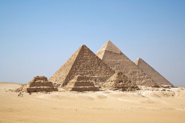
Let's first understand a little bit about the age of these attractions.
Historians still find it difficult to establish an exact date, however, claiming that the pyramids were built for the pharaohs who lived in the corresponding era. However, according to the official dating of the Sphinx, it was built in 2500 BC. According to alternative versions of history, the time of construction of the Sphinx differs significantly from each other. Some claim that it is more ancient than 200 thousand years ago, that it could have been built between 15 and 5 thousand years BC, while others, on the contrary, say that it is no more than 200 years old.
Nevertheless, there are ancient manuscripts that tell about the age of the megalithic structures of the Giza plateau.
In the "Emerald Tablets" Hermes Trismegistus speaks of the age of the Sphinx in 10-15 thousand years. According to ancient legends, the author of the tablets was Thoth, the scribe of the gods, an intermediary between people and the gods, and even knew the secrets of the lost Atlantis. It was on his grave that an emerald tablet with the text of the Atlantean teachings was found, which confirms its antiquity. Although again, not a fact. It may well turn out that the tablet was put much later, justifying the antiquity of the Sphinx. Here I do not assert anything but only assume.
Elena Blavatsky writes in "The Secret Doctrine" that the pyramids and the Sphinx were created by the Atlanteans 200 thousand years ago. And Edgar Cayce said that they were built between 10490 and 10390 BC. He, by the way, also told a lot about Atlantis. But today is not about her.
Obviously, the testimony of the "witnesses" differs. And then there were the ancient maps, which is a strange way periodically appear from suddenly found archives and are now walking all over the Internet. On these maps, in addition to drawing the contour of the continents, interesting details of the lands were depicted. Cities in the form of fortresses, animals, probably those that lived there or that map makers heard about, other sights of the country or city. But for some reason, the pyramids and the Sphinx, as one of the wonders of the world, are not there. See for yourself.
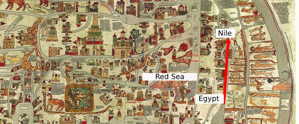
Map of Ebstorf 1234
Take the earliest map of Ebstorf in 1234. An amazing work of real art. Almost every piece of space is filled with small pictures depicting animals (I found them strange), incomprehensible people, and throughout the area - turrets, castles, and fortresses. But where the Nile is only some natives ride. The builders of the pyramids?))
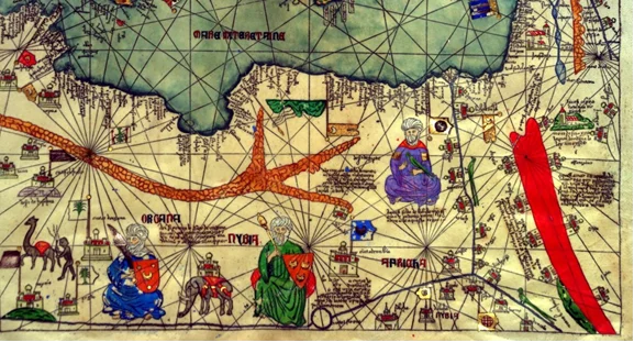
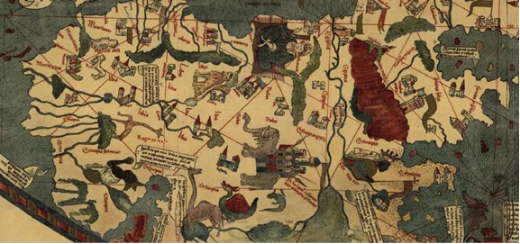
Catalan map of 1375
Catalan map of 1375 In the north of Africa, the Red Sea is marked with a red stripe. The man in purple looks like he's sitting in Egypt, as the Nile flows next to him. But for some reason, there are no pyramids again. It's kind of weird.
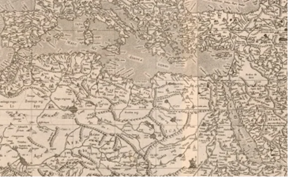
Map of Toscanelli 1475
Map of Toscanelli 1475 Similarly, we look at the north of Africa. Again, animals, elephants, leopards, and fortresses with turrets are drawn in detail. A hundred years have passed since the compilation of the Catalan, and almost nothing has changed. And why is there a huge man, signed "Vulcanus", sitting with his legs crossed and pointing at Alexandria? Along the bank of the Nile, too, turrets are drawn, but there are no pyramids anywhere. What is it?
Mercator Map of 1569
And of course, the most famous map of the Flemish cartographer Gerard Mercator in 1569, with many details drawn on the land and unthinkable animals, even sea animals. The advantage of the map is that the world on it appears rectangular, and not oval and round, as before it. Although some inconsistencies are visible, we will not pay attention to them.
Then there were no satellites and Google maps. Nevertheless, this is the most detailed map of the world, in which the cartographer took into account even the legends and stories of sailors and travelers. There are notes about the life and customs of the inhabitants of different countries. But there are no pyramids.
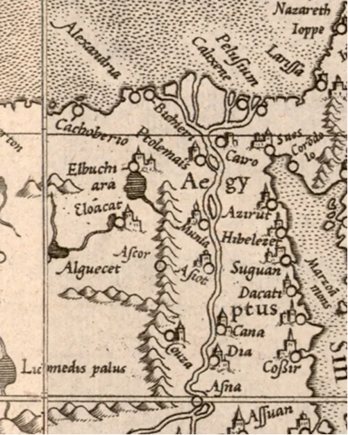
Mercator Map of 1569
Although later in the collection "Atlas, or Cosmographic reflections on the structure of the world and the acquisition of images", published in 1595, Mercator depicted something similar to the pyramids near the Nile. Or are they just mountains? It seems to me that the mountains. What do you think?
Mercator. Atlas, 1595.
Well, tell me, what the hell is going on with all these cards? After all, the pyramids of Giza and the Sphinx are now a wonder of the world, it is not clear who built them. But if they are so ancient, why is there not a word about them on the old maps, not a single picture?
After all, they are even easier to draw than fortresses and turrets. Or, as one researcher says, were they built just 200 years ago when Napoleon invaded Africa? Why the hell would he do that? He had disagreements with Europe planned.
But there is an opinion that before the discovery of the pyramids by Napoleon, they were not any wonder of the world. Abandoned, sand-covered pyramids and a small animal. Therefore, they were not marked on the maps. Or maybe the ancient cartographers did not consider it necessary to depict such pyramids, which were set up all over the Earth in considerable numbers, for fear of confusing travelers? There are more questions than answers.
I still think the pyramids are older than the maps. And the maps can be inaccurate for various reasons, from the falsification of the maps themselves to the burying of the pyramids. And you can see about the buried cities here. Don't forget to watch the video about Egypt's monuments below:
About author:
Serg Toporkov Ufologist, Ph.D., blogger, I go on my own expeditions for UFOs. I use scientific methods to investigate the UAP phenomenon. Write to me |
Related tags:
Giza plateau Sphinx ancient maps Africa Mercator Atlantis Catalan map Map of ToscanelliRandom UFO or conspiracy article
Square cornered clouds appear over the territory of the whole Earth-analysis
 Meteorologists can not explain the nature of the mysterious phenomenon. Clouds are usually formless. And what form can there be of steam floating in the sky? However, it appears from time to time. The clouds become square, surprising observers with their smooth edges.