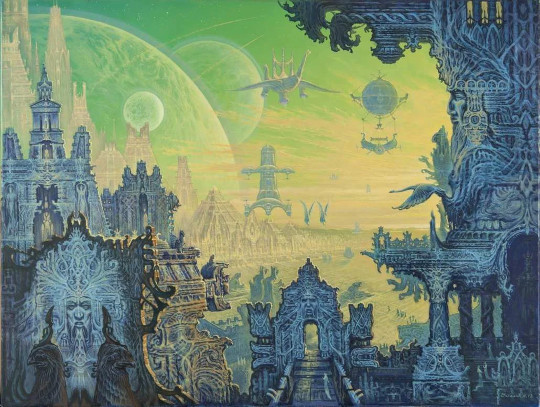
Did Hyperborea exist - is it a mysterious continent in the Arctic?
The ancient Greek historian Herodotus described the mysterious country of Hyperborea as a land inhabited by higher beings whose level of development was many thousands of years ahead of its time. The first known attempt to reach it was made in the VII century BC. e. A certain Aristaeus left behind a detailed description of the route, which ended on the shore of the Extreme (Kara) Sea. Despite the presence of fairly accurate coordinates, no one else managed to get to Hyperborea.
Mercator Maps
The Russian National Library houses the largest collection of works by Gerard Mercator. On the occasion of the 500th anniversary of the birth of this outstanding Flemish cartographer, an exhibition was opened there, where for the first time his original maps and atlases were shown to the public. The whole scientific world agrees that they are surprisingly accurate. Considering that in the XVI century there were no airplanes or satellites.
Among dozens of other works at this exhibition, a fairly detailed map of the Northern Hemisphere, dated 1569, was presented. It has a blooming Greenland with numerous settlements and mountain ranges, which the modern world learned about only in the XX century. There is the Bering Strait and Hyperborea, which is also called Arctida.
Some may assume that Mercator simply invented certain lands near the North pole or drew on his map what ancient Greek myths and legends told about. Possible. But in his quest to embellish reality, he is not alone. Other cartographers of the 16th century, both European and Arab, depict a certain mysterious land in this area.
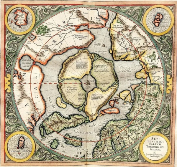
Mercator Map of the Northern Hemisphere.
It is found on the map of 1507 by the German traveler Johannes Ruishi, confirmed by the Arab geographer Khoja Ahmed in 1559 and the Spanish cartographer Urbano Monte in 1587. It is noteworthy that the last of them depicted the earth in great detail - with mountain ranges and rivers-and also drew in detail the modern Russian Arctic coast. There is also a detailed image of blooming Antarctica on its map, which will be discovered only in two centuries.
It should be noted that in those days there were no printing houses and such things were created manually for months, perhaps even years. This means that cartographic images are based on information obtained long before their actual creation in the XVI century. The fact that each author draws his own unique outline of the Arctic suggests that they all relied on some exclusive data obtained from reliable sources. One can only imagine how much time such voyages around the world took. This circumstance also allows that by the time the work was completed, the reality could have changed dramatically due to some natural disasters of irresistible force.
A vanished continent
In pseudo-scientific circles, there is a point of view that Hyperborea gradually plunged into the waters of the oceans for decades. Something similar is happening today in the British Isles. This explains the numerous floods that medieval Europeans suffered from. There is also indirect confirmation on maps dated to the beginning and end of the 16th century: the land is shrinking all the time. A little more time passes, and it disappears completely.
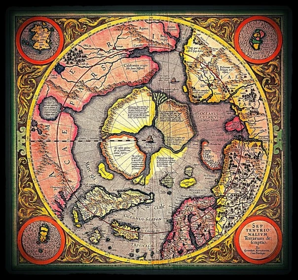
Later map of Mercator.
At the beginning of the XVII century, Hyperborea completely disappears from all maps of the world. The Northern route is no longer navigable. In the Arctic came the terrible cold, ice-bound coastal seas. There are no North-Western coasts of North America. Research and merchant ships do not enter this area, so cartographers, without getting any reliable information, draw only solid white spots - terra incognita. The situation is similar to Antarctica. During the lifetime of one generation, an entire continent disappeared, the existence of which was quickly forgotten.
The so-called "Zeno map", first published in 1558 by one of the Venetian merchants, also testifies to a certain large-scale cataclysm. It shows in sufficient detail the North Atlantic, which was repeatedly visited by his relatives in the XIV century. Among the famous Islands, there is a meticulously drawn coast of Greenland with many settlements. The author portrays exactly as the name says - "green country". When it turned into an almost deserted snowy desert, it is not known for certain.
Another interesting fact is connected with three Arctic expeditions of the Dutch explorer Willem Barents, after whom the Barents Sea is named. At the end of the 16th century, he made several attempts to reach the east indies (southeast Asia) by the northern route. The traditional route of spice delivery along the African coast - the southern route – was not only entirely controlled by the Spaniards and Portuguese, but was merely dangerous because of pirate attacks.
The first expedition set out from Amsterdam in 1594. Barents was a cartographer by profession, so he had the necessary knowledge and was confident in his own abilities. He was looking forward to a long but in every way pleasant voyage. The ships and equipment were the same as for the Atlantic crossing. To the navigator's surprise, as he rounded the Scandinavian peninsula, he felt a terrible cold and saw ice floes covering the surface of the water all the way to the horizon. The intrepid Dutchman could not understand what was wrong with his old maps and information about the northern hemisphere. Why is it so cold and there is so much impassable ice?
He's back. A year later, he assembled a new expedition of seven ships and again went to sea. This time I decided to go closer to the shore, but an insurmountable obstacle was the Yugorsky Shar Strait, which, as we know today, is frozen most of the year. During the third campaign, the brave Navigator reached Novaya Zemlya.
The two expedition ships were trapped in ice. The crew went ashore, built a hut, and waited for the weather to improve. After some time, having lost their captain and completely desperate, the sailors went to the Kola Peninsula in two boats and were rescued by Russian fishermen. Their winter quarters are in a fairly tolerable condition and the Barents grave was found 300 years later.
Will history have to be rewritten?
The Northern sea route was only conquered by Russian explorers. The first to reach the mysterious Strait between Asia and North America, the existence of which in enlightened Europe was known for a single century, were the Cossacks of Semyon Dezhnev. Today it is named after the Russian Navy officer Vitus Bering, who passed through these waters almost 80 years later.
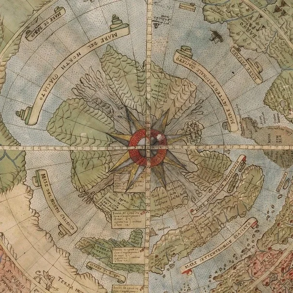
Map Of Urbano Monte.
In 1788, the archive discovered a manuscript of the Spanish Navigator Alonso Maldonado, dated to the XVI century. The author describes how, after leaving the Gulf of Mexico, he calmly took the Northern route around modern-day Canada and entered the Pacific ocean. The official history, in turn, States that the Norwegian polar explorer Roald Amundsen was the first to follow this path in 1906.
Today, the scientific world is trying to disown this manuscript, and calls it an "artifact", because the events described in it could not have happened by definition. If we accept the fact as reliable, then we will have to review the entire world history and, in particular, confirm the real existence of Hyperborea.
About author:
Serg Toporkov Ufologist, Ph.D., blogger, I go on my own expeditions for UFOs. I use scientific methods to investigate the UAP phenomenon. Write to me |
Related tags:
Mercator map Hyperborea Arctic Aristaeus Herodotus Greenland Johannes Ruishi conspiracy hidden continent Urbano Monte vanished continent Willem Barents Semyon Dezhnev Russian Navy Vitus Bering Roald Amundsen Alonso Maldonado history Zeno mapRandom UFO or conspiracy article
Puerto Maldonado UFO incident
 Another UFO photo that requires careful consideration and our analysis.